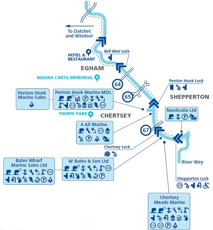
Chertsey Lock
Right bank lock, length: 200'8", width:21'
Chertsey Weir for canoists.
See also.
Chertsey Campsite LEFT bank below weir 01932 562405
1793: Whitworth first surveyed for a lock.
1805: Rennie planned a cut from the southern extremity of Penton Hook
to near Chertsey Bridge, about 2500 yards,
to contain a poundlock with a fall of 5ft 6in. avoiding Laleham Gulls -
where the fall is so great and the river so imperfect
1809: Rennie proposed -
A wier with Rymers just above the tail of Chertsey Abbey Mill, to pen the water in summer over Laleham Gulls. Then to make a cut (to the north) to Doomsday Bushes with a poundlock in it.
1811: Lord Lucan asked to have the lock as far removed from his outlook as possible.
1813: Chertsey Lock opened.
Chertsey Lock coloured Slide by "J.V." -

Chertsey Lock coloured slide, J.V.
1870: Chertsey Lock and Bridge by Henry Taunt -

Chertsey Lock and Bridge, Taunt, 1870
© Oxfordshire County Council Photographic Archive; HT1485
1890: Chertsey Lock, Francis Frith -

1890: Chertsey Lock, Francis Frith
1893: Lock lengthened.
1913: Fred Thacker (writing in 1920)–
Two thirds of the weir is
entirely open. The central portion
possesses some tackle.
At the end of
1912 a scheme was adopted for rebuilding the lock 201 ft. long and 21 ft.
broad, divided into two compartments of dimensions similar to the new
Boulter’s. The new station was to be
ready by March 1913.
In a driving
rainstorm on Christmas Eve 1912 I walked over Shepperton to revisit the old
structure, already half demolished. It
now has three pairs of gates.
1965: Chertsey Lock and Bridge, Francis Frith -

1965: Chertsey Lock and Bridge, Francis Frith
1965: Chertsey Lock, Francis Frith -

1965: Chertsey Lock, Francis Frith