
Canvey Island
North bank Island formed by the Thames, Benfleet Creek, Easthaven Creek and Holehaven Creek.
Paintings of Canvey Island
There are flood barriers in Benfleet Creek and Easthaven Creek (and further up Holehaven Creek) -
Benfleet Creek Tidal Barrier

Easthaven Creek Tidal Barrier

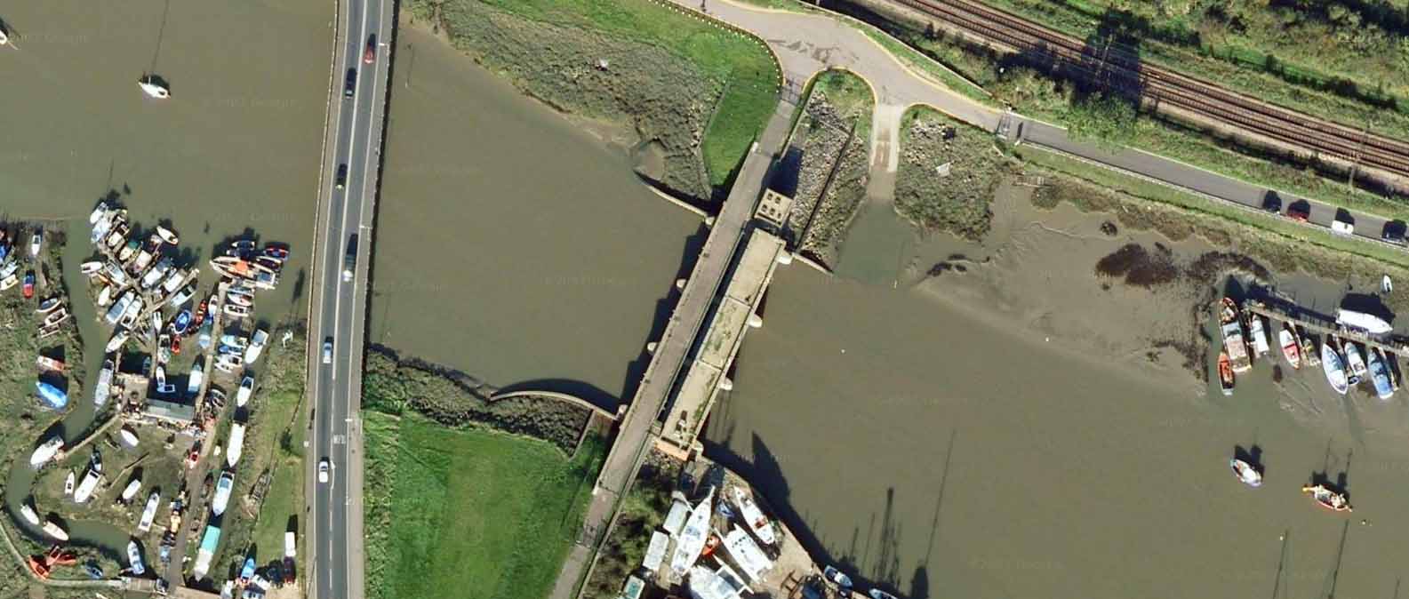
Hole Haven Creek Tidal Barrier
1610: Camden -
Afterwards this river, passing by places lying flat and unholsome,
with a winding returne of his water, severeth the Island Convennon,
which also is called Counos (whereof Ptolemee maketh mention) from the firme land.
This hath not yet wholie forgone the old name, but is called Canvey.
It lieth against the coast of Essex, from Leegh to Hole Haven, five miles in length,
some part whereof appertaineth to the Collegiat church of Westminster.
But so low that often times it is quite overflowen, all save hillocks cast uppe,
upon which the sheepe have a place of safe refuge.
For it keepeth about foure hundered sheepe, whose flesh is of a most sweet and delicate taste,
which I have seene young lads, taking womens function, with stooles fastened into their buttokes to milke,
yea and to make cheeses of Ewes milke in those dairy sheddes of theirs that they call there wiches.
There adjoyne to this Island along in order, first Beamfleot, fortified with deepe and wide trenches
(as saith Florilegus) and with a Castle, by Hasting the Danes, which King Aelfred wonne from them;
then Hadleigh, sometime the Castle of Hubert de Burgo, afterwards of Thomas of Woodstock Duke of Glocester,
and now defaced with ruines;
and in the last place Leegh, a proper fine little towne and verie full of stout and adventurous sailers;
with Pritlewel fast by, where Swen de Essex built long since a Cell for Monkes.
And heere the land shooteth forward to make a Promontory, which they call Black-tayle Point and Shobery Nesse,
of Shoberie, a village situate upon it, which sometime was a citie named Sceoberig.
For in the old Annales of the English Saxons we read thus,
The Danes, being driven from Beamfleot, goe to a City seated in East-sex called in the English tongue
Sceobirig, and there built themselves a sure and strong Fort.
Heere by reason that the bankes on both sides shrinke backe,
the Tamis at a huge and wide mouth rowleth into the sea.
This doth Ptolomee tearme Aestuarium Tamesae, and corruptly in some other copies Temesae,
and we commonly call the Tamis Mouth.
1885: Dickens's Dictionary of the Thames, Map [Canvey Island to Gravesend] -

Canvey Island to Gravesend, Dickens, 1885
11 Frith photos of Canvey Island
Allhallows Yacht Club
South Bank, opposite Leighbeck Point.
Allhallows yacht Club website.
Powered boats and sports, two ramps into sea available 3 hours either side of high tide.
Leighbeck Point
North Bank, the most easterly tip of Canvey Island, to the north of it is Hadleigh Ray, and then Benfleet Creek
Island Yacht Club
History of the Island Yacht Club
Chapman Sands
1849: Chapman Sands Lighthouse built
1885: Dickens's Dictionary of the Thames -
Chapman Lighthouse is an iron screw-pile structure, painted red, built on Chapman Head, in Sea Reach.
It shows towards the eastward a red light over the sand called the River Middle, and a white light
in the safe channel; to the westward its light is wholly white, and is designed to lead vessels
clear of a danger called the Scar.
The piles have each a Mitchell's screw at the lower end, by means of which they were driven
into the sand when the structure was built, in 1851.
Above the wash of the water, a six sided chamber contains the
accommodation for the keepers, two in number,
which is surmounted by a six sided lantern, enclosing
a dioptric or lenticular apparatus of the second order, in the centre of which is the source of light,
a fountain lamp, with four concentric wicks burning colza oil.
The light since January, 1881, is occulting, disappearing twice in quick
succession every
half minute. The total height of the building from base to vane is 74 feet, and the light is exhibited at an elevation
of 40 feet above high water.
Three keepers are employed: two on duty and one on shore, and the relief is effected once a month,
by a steamer from the Trinity depot at Blackwall, so that each man serves two months at the lighthouse,
and has one month in three on shore.
1899: "The Heart of Darkness" by Joseph Conrad -
The sun set; the dusk fell on the stream, and lights began to appear along the shore. The Chapman lighthouse, a three-legged thing erect on a mud-flat, shone strongly. Lights of ships moved in the fairway - a great stir of lights going up and going down. And farther west on the upper reaches the place of the monstrous town was still marked ominously on the sky, a brooding gloom in sunshine, a lurid glare under the stars.
1930: Jetty and lighthouse -

Chapman Sands Jetty, 1930

Chapman Sands Lighthouse, 1930
1931: The Thames by C Fox-Smith -
Chapman Sands extend along practically the whole of the river side of Canvey Island. and the light at their seaward extremity, standing up out of the mud on its iron stilts like some Cubist's representation of a wading bird, is one of the most familiar objects to all shipping using the London River.
Chapman Lighthouse copyright Mike Millichamp -
The last of the London River lighthouses was built here in 1849.
At 39 miles from London Bridge and known as Chapman lighthouse it was a screw pile structure
with accommodation for three keepers. A rowing boat was suspended for use in high tides.
The lighthouse was painted red and remained so during both World War I
and World War II
as it was an important meeting point for many convoys waiting an armed escort
before leaving the estuary.
The light was evacuated in 1956 when it was discovered that the iron screw piles
were rusting away and by 1958 all trace of the lighthouse had been removed.
Chapman Sands Yacht Club
Chapman Sands yacht Club website
Sea Reach No 7 mark
Chapman Anchorage Buoy
Yantlet Channel
St Mary's Bay
South bank bay opposite Canvey Island
Not to be confused with the place of the same name in the Romney Marshes
Scars Elbow Buoy
Southeast of Scars Elbow Point on Canvey Island
Calor Gas Ltd
35,000 tonnes of Refrigerated LPG storage comprising six 5,000 tonne capacity and two 2,500 tonne capacity storage tanks. The double skinned tanks are capable of storing LPG at -43 degrees centigrade. Vessels up to 300 metres loa on 97 metres jetty head. Depth 12 metres CD.
Tanker Traffic Warning Light
When flashing, these indicate that large tankers are manoeuvring at Coryton.
Egypt Bay
South bank bay opposite Oikos Storage
Smuggling website -
Egypt Bay on the Hoo peninsula was a typical Thames estuary landing spot,
though its soft and changing outline has now been made regular and permanent by the concrete sea defences.
Inland from the bay, though, there's still a reminder of the smuggling activity
that was once rife here: Shade House was built specifically to aid the landing of contraband
on the southern shores of the Thames: significantly, all the windows of this peculiar box-like building
face inland, to provide a good view of anyone approaching within a mile or so.
The cottage is even now extremely isolated, but would have been more so in the 18th century:
the marshes were malarial, and most people lived on higher ground farther inland.
Local stories tell of vaulted brick tunnels leading from Shade House towards the river,
but there is no visible evidence today to back up these tales.
However, we do know that the North Kent gang used Shade House in their smuggling activities,
driving the many marsh sheep along the trails they had followed inland
so that there would be no tell-tale footprints.
Oikos Storage Ltd
North Bank, on Canvey Island Oikos website -
Oikos has been active in Canvey Island for over seventy years.
We have an excellent safety record and are proud of our on-going contribution
to the Island's economic development by bringing skilled jobs and investment to the area.
Oikos' location as a convenient ingress point into the UK from the Antwerp-Rotterdam-Amsterdam region,
together with its existing connections to the national pipeline distribution networks,
demonstrate that it is a strategic and vital part of the United Kingdom's infrastructure
for road, jet and bunker fuel distribution.
Oikos is able to deliver product via pipeline to Stansted airport, with interconnections to Heathrow and Gatwick.
Holehaven Pier